 Geosur
asNeeded
Type of resources
Available actions
Topics
INSPIRE themes
Keywords
Contact for the resource
Provided by
Years
Formats
Representation types
Update frequencies
status
Scale
-
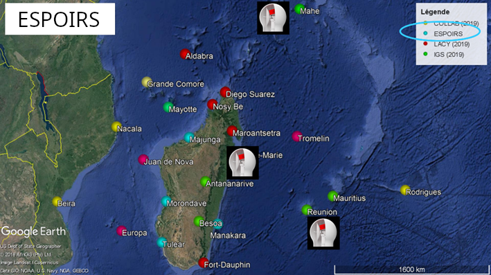
This ressource is part of the action 1 of the ESPOIRS Project. Multiple GNSS Stations have been installed or updated in the SWIO and the data are available here. "TO ADD : Different datasets, list of stations, etc ...."
-
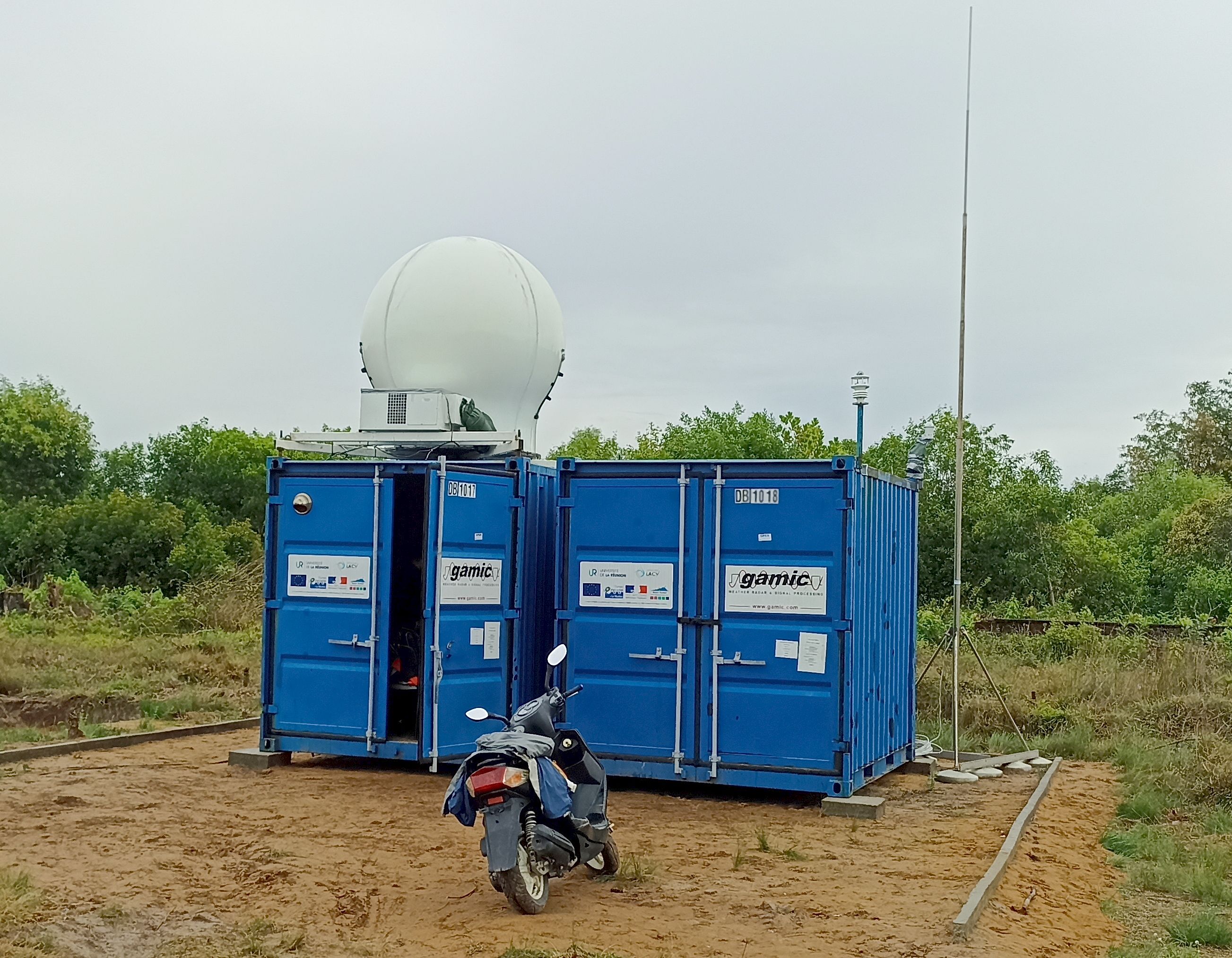
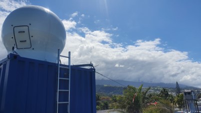
The ressource describes the dataset obtained by deploying the GAMIC GMWR-25-DP RADAR in Toamasina (Tamatave) in Madagascar.
-

The coastline or shoreline is the geographical boundary between sea and land. It corresponds according to the SHOM to "the leash of the highest seas in the context of an astronomical tide of coefficient 120 and under normal weather conditions (without overcost phenomenon). The coastline as defined above is not directly identifiable continuously on the ground or on a satellite or aerial image. From a perspective of studying the displacement of the shoreline, indicators allow us to approach this notion (the vegetation limit associated with the infrastructure limit, the beach limit, etc.). On the reef shoreline of Reunion Island the limit of vegetation and infrastructure as well as beach limit were retained. This limit results in the production of a line-type vector geographic information layer in a GIS resulting from photo-interpolation on the orthophotos of IGN also called BD ORTHO. BD ORTHO is a component of the RGE®. These are digital color orthophotos supplied in raster format (tiff, ecw, ..). An orthophotography is a digital image that has the same metrics as a map of the same projection for the same elements on the ground. They have been available since 1997 in Réunion with a five-year repeatability. Their spatial resolution increased from 1 m in 1997 to 50 cm in 2003. UMR Espace-Dev
-
.png)
Le radar BASTA est un radar nuage (95GHz) dédié à l’étude des nuages et du brouillard. Le radar mesure l’énergie rétrodiffusée par les hydrométéores, cette énergie peut donc être reliée à la quantité d’eau contenue dans le nuage (liquide et glace). Il fonctionne en routine quotidiennement sur le site de l’observatoire du Maïdo, sur l'Ile de La Réunion. Le radar BASTA Réunion a été calibré au LATMOS avant son installation à la Réunion. Ce jeu de données est au format niveau L0. Paramètre principal: Profil vertical de réflectivité radar, mesure du décalage Doppler. Contexte de la mesure: observation routine.
-
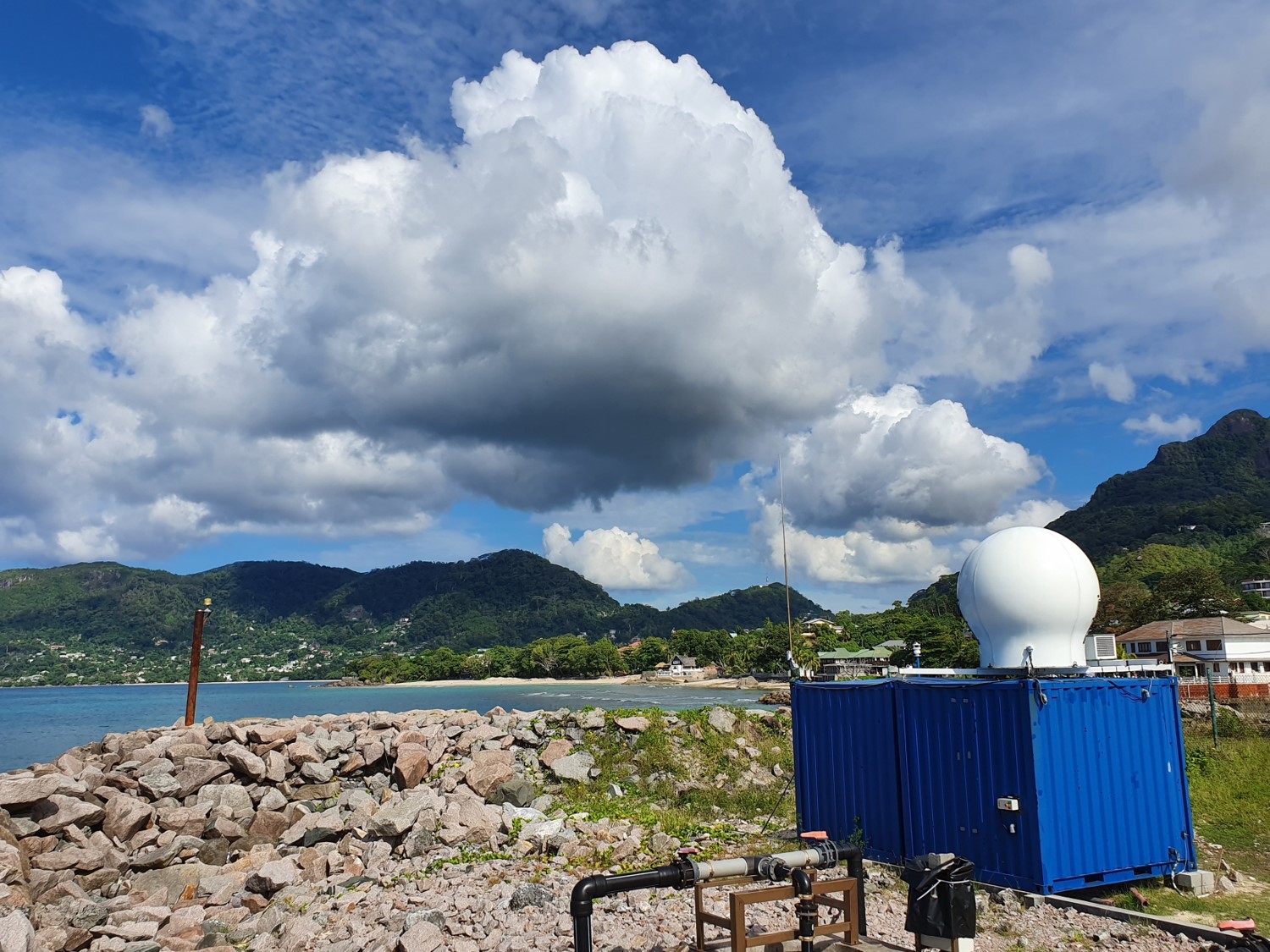
The ressource describes the dataset obtained by deploying the GAMIC GMWR-25-DP RADAR in the north of Mahé Island, in Seychelles.
-
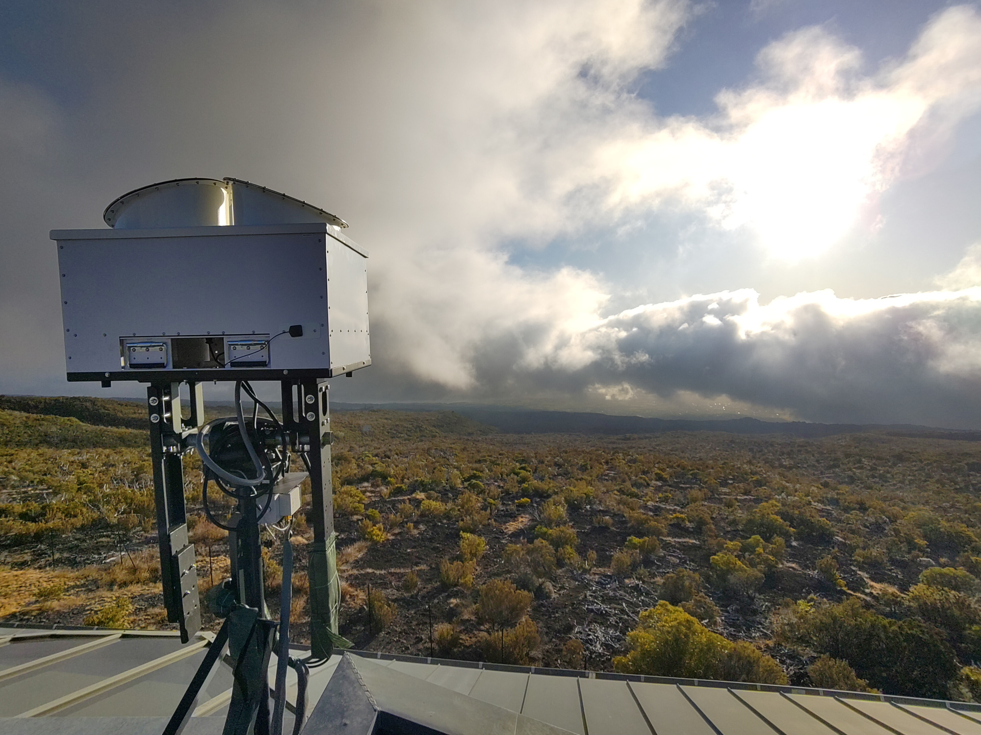
Le radar mini-BASTA est un radar nuage (95GHz) dédié à l’étude des nuages et du brouillard. Le radar mesure l’énergie rétrodiffusée par les hydrométéores, cette énergie peut donc être reliée à la quantité d’eau contenue dans le nuage (liquide et glace). Il fonctionne en routine quotidiennement sur le site de l’observatoire du Maïdo, sur l'Ile de La Réunion. Ce jeu de données est au niveau L0, et les données sont non calibrées. Paramètre principal: Profil vertical de réflectivité radar, mesure du décalage Doppler. Contexte de la mesure: observation routine.
-

The beach profile is a sectional representation of its topography. The beach topography and its dynamics (by beach profile or transect approach) is illustrated by the acquisition of altimetry data along a fixed profile. 42 profiles are regularly monitored on the reef coast of Reunion Island: 2 profiles per year before the swell seasons of summer and austral winter; the impact of the events of strong swells (cyclones, southern swells) is systematically measured on the labeled Dynalit sites and more sporadically on the other sites. The methodology deployed locally since 2012.
-
The ressource describes the dataset obtained by deploying the GAMIC GMWR-25-DP RADAR in the South of Reunion Island, in Saint Joseph.
-

The overall objective of the ESPOIRS project is to obtain a better understanding of the variability, statistical properties and formation mechanisms of intense tropical precipitation at regional and local scales. ESPOIRS is thus interested in the entire life cycle of precipitation at several space-time scales. * Through the analysis of the distribution of the large-scale humidity field which drives the formation of precipitation at the regional scale using a GNSS network. * Through the characterization of internal (dynamics, microphysics) and external (interactions with the relief) processes, which drive the formation and life cycle of extreme weather events at the local scale => transportable Polarized Doppler X-band precipitation radar.
-
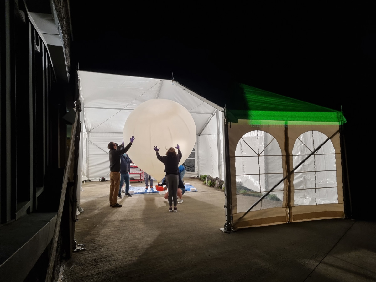
This dataset provides the processed ECC ozonesonde radiosoundings performed for 5 consecutive nights at the Maïdo Observatory (21.08°S, 55.38°E) on Réunion Island during the period 20-25 January 2022 following the eruption of the Hunga Tonga volcano on 15 January. Réunion Island is in the Southwest Indian Ocean and holds one of the very few atmospheric observatories in the subtropical Southern Hemisphere.