
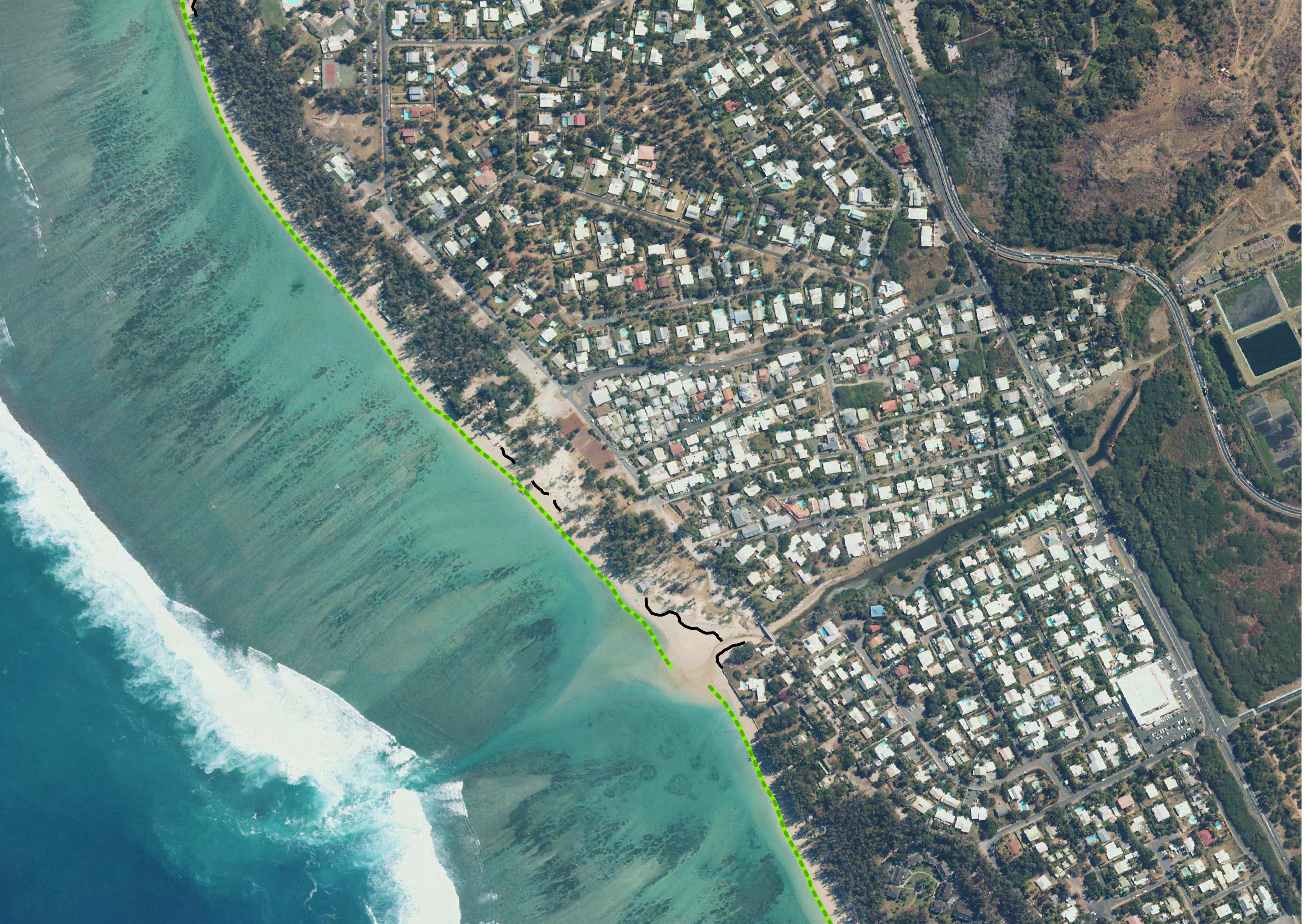
National Observation Service Dynalit, focuses on Coastline by BD ORTHO®, Reunion Island
The coastline or shoreline is the geographical boundary between sea and land. It corresponds according to the SHOM to "the leash of the highest seas in the context of an astronomical tide of coefficient 120 and under normal weather conditions (without overcost phenomenon). The coastline as defined above is not directly identifiable continuously on the ground or on a satellite or aerial image. From a perspective of studying the displacement of the shoreline, indicators allow us to approach this notion (the vegetation limit associated with the infrastructure limit, the beach limit, etc.).
On the reef shoreline of Reunion Island the limit of vegetation and infrastructure as well as beach limit were retained. This limit results in the production of a line-type vector geographic information layer in a GIS resulting from photo-interpolation on the orthophotos of IGN also called BD ORTHO. BD ORTHO is a component of the RGE®. These are digital color orthophotos supplied in raster format (tiff, ecw, ..). An orthophotography is a digital image that has the same metrics as a map of the same projection for the same elements on the ground. They have been available since 1997 in Réunion with a five-year repeatability. Their spatial resolution increased from 1 m in 1997 to 50 cm in 2003.
UMR Espace-Dev
Simple
- Date (Creation)
- 2012-01-01T00:00:00
- Presentation form
- Digital map
- Purpose
- Réaliser des profils topographiques de 39 plages de la Réunion
- Status
- Under development
- Point of contact
-
Organisation name Individual name Electronic mail address Role Espace-Dev
Gwenaëlle Pennober
Originator
- Maintenance and update frequency
- As needed
- Theme
-
-
Elevation
-
Reefal beach
-
BD ORTHO®
-
Dynalit
-
SNO "Traît de côte", littoral management
-
- Place
-
-
Indian Ocean
-
Reunion island
-
- Access constraints
- Restricted
- Use constraints
- Restricted
- Spatial representation type
- Vector
- Denominator
- 1
- Language
- English
- Character set
- UTF8
- Topic category
-
- Geoscientific information
- Elevation
- Begin date
- 1997
- End date
- en cours...
))
- Reference system identifier
- EPSG : 4326
- OnLine resource
- Hierarchy level
- Dataset
Metadata
- File identifier
- 1db1604b-bfbc-4312-8c6f-dc7b10ebb78d XML
- Metadata language
- English
- Character set
- UTF8
- Date stamp
- 2026-04-22T09:10:25.860314Z
- Metadata standard name
-
ISO 19115:2003/19139
- Metadata standard version
-
1.0
- Metadata author
-
Organisation name Individual name Electronic mail address Role UMS3365
Rémy Decoupes
Custodian Espace-Dev
Philippe Rouet
Custodian
- Other language
-
Language Character encoding French German Chinese(Other) Arabic Spanish; Castilian Russian English UTF8
Citation proposal
Gwenaëlle Pennober.
National Observation Service Dynalit, focuses on Coastline by BD ORTHO®, Reunion Island [Data set].
https://geosur.osureunion.fr/geonetwork/srv/api/records/1db1604b-bfbc-4312-8c6f-dc7b10ebb78d

)))