ERORUN-STAFOR: A collaborative observatory for the multidisciplinary study of the Critical Zone Processes in a tropical volcanic watershed including a Tropical Montane Cloud Forest, Reunion Island
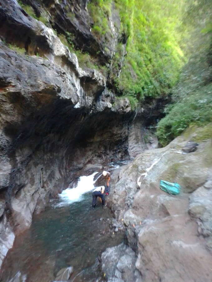
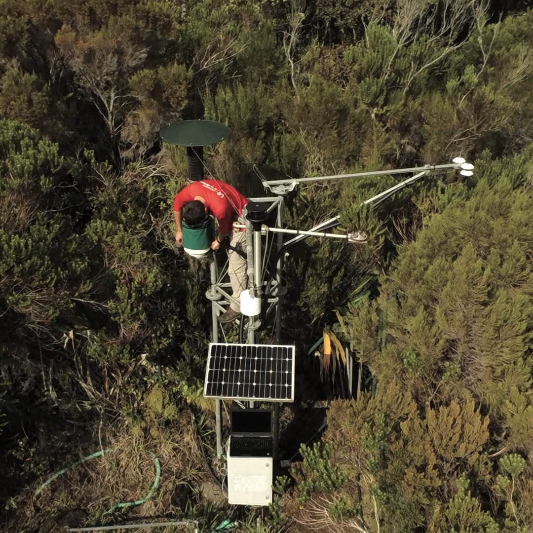
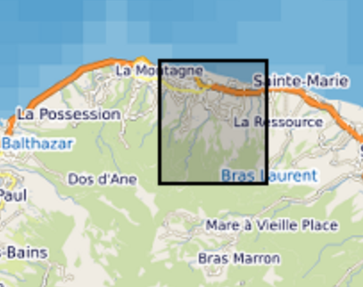
The dataset of the first observatory from the French network of critical zone observatories (OZCAR) located in an insular tropical and volcanic context, integrating a “Tropical Montane Cloud Forest”: The ERORUN-STAFOR observatory. This collaborative observatory is located in the northern part of La Réunion island (Indian Ocean) within the watershed of Rivière des Pluies (45.0 km²) which hosts the TMCF of Plaines des Fougères, one of the best preserved natural habitats in La Réunion Island. Since 2015, the ERORUN-STAFOR monitoring in collaboration with local partners collected a multidisciplinary dataset with a constant improvement of the instrumentation over time. At the watershed scale and in its vicinity, the ERORUN-STAFOR observatory includes 10 measurement stations covering the upstream, midstream and downstream part of the watershed. The stations record a total of 48 different variables through continuous (sensors) or periodic (sampling) monitoring. The dataset consists of continuous time series variables related to (i) meteorology, including precipitation, air temperature, relative humidity, wind speed and direction, net radiation, atmospheric pressure, cloud water flux, irradiance, leaf wetness and soil temperature (ii) hydrology, including water level and temperature, discharge and electrical conductivity (EC) of stream, (iii) hydrogeology, including groundwater level, water temperature and EC in two piezometers and one groundwater gallery completed by soil moisture measurements under the canopy. The dataset is completed by periodic time series variables related to (iv) hydrogeochemistry, including field parameters and water analysis results. The periodic sampling survey provides chemical and isotopic compositions of rainfall, groundwater, and stream water at different locations of this watershed. The ERORUN-STAFOR monitoring dataset extends from 2014 to 2022 with an acquisition frequency from 10 min to hourly for the sensor variables and from weekly to monthly frequency for the sampling. Despite the frequent maintenance of the monitoring sites, several data gaps exist due to the remote location of some sites and instrument destruction by cyclones. This observatory is a unique research site in an insular volcanic tropical environment offering three windows of observation for the study of critical zone processes through upstream-midstream-downstream measurements sites. This high-resolution dataset is valuable to assess the response of volcanic tropical watersheds and aquifers at both event and long-term scales (i.e. global change). It will also allow various progress in understanding the significant role of the TMCFs in the recharge processes, the hydrogeological conceptual model of volcanic islands, the watershed hydrosedimentary responses to extreme climatic events and their respective evolution under changing climatic conditions.
Simple
- Date (Creation)
- 2023-11-20T17:00:00
- Presentation form
- Digital document
- Purpose
- Caractérisation physico-chimique de l'eau
- Status
- Completed
- Point of contact
-
Organisation name Individual name Electronic mail address Role LGSR
Jean-Lambert Join
Point of contact LGSR
Alix Toulier
Author OSU-Réunion, UAR3365
Pierre Stamenoff
Processor OSU-Réunion, UAR3365
Yoan Benoit
Processor OSU-Réunion, UAR3365
Sophie Ferreira
Processor OSU-Réunion, UAR3365
Magali David
Processor PVBMT
Claudine Ah-Peng
Point of contact
- Maintenance and update frequency
- Continual
- Theme
-
-
Meteorology
-
Hydrology
-
Hydrogeology
-
Hydrogeochemistry
-
- Place
-
-
Reunion Island
-
Watershed "Rivière des Pluies"
-
- Access constraints
- License
- Use constraints
- License
- Other constraints
-
All data produced by the ERORUN-STAFOR observatory were funded by French public funding. As such, in agreement with national policy including CNRS Open Science National Plan, the data have to be freely available and downloadable and exclusively for non-commercial use. Data are under Creative “Commons Attribution” License 4.0 (CC BY 4.0 ).This license enables reusers to distribute, remix, adapt, and build upon the material in any medium or format, so long as attribution is given to the creator. Reusers should also inform the PIs, science coordinators and/or the data steward of their published work featuring the data. Reusers should cite the data with the following sentence:
“ERORUN-STAFOR observatory dataset has been collected thanks to the financial support of Institut National des Sciences de l’Univers (INSU-CNRS), Université de La Réunion (UR), Météo-France, Institut de Recherche pour le Développement (IRD), Laboratoire Géosciences Réunion, Observatoire des Sciences de l’Univers de La Réunion (OSU-Réunion), French network of critical zone observatories (OZCAR) and also from European Regional Development Fund (ERDF, La Réunion Regional Council, European Commission, French State) under program LABELS-IR-INFRA (GURDTI/20201872-0025807). Qualified datasets can be accessed from zenodo repository ( https://doi.org/10.5281/zenodo.7983138) as well as from OZCAR-Theia repository ( https://catalogue.theia-land.fr/).
Data produced by partners and collaborators of ERORUN-STAFOR observatory are only shared within the members of the observatory and their availability to the public is managed by each organization according to their own policy.
- Spatial representation type
- Vector
- Denominator
- 1
- Language
- English
- Character set
- UTF8
- Topic category
-
- Inland waters
- Environment
- Begin date
- 2014-11-29
- End date
- 2022-03-17
))
- Reference system identifier
- EPSG:4326
- OnLine resource
- Hierarchy level
- Dataset
Conformance result
- Date (Publication)
Metadata
- File identifier
- 90be6d47-8c40-47fe-9b9a-df20c95a6a96 XML
- Metadata language
- English
- Character set
- UTF8
- Date stamp
- 2024-03-08T07:44:47
- Metadata standard name
-
ISO 19115:2003/19139
- Metadata standard version
-
1.0
- Metadata author
-
Organisation name Individual name Electronic mail address Role OSU-Réunion, UAR3365
Victor K/BIDI
Custodian
- Other language
-
Language Character encoding French English UTF8
Citation proposal
Jean-Lambert Join (LGSR), Alix Toulier (LGSR), Pierre Stamenoff (OSU-Réunion, UAR3365), Yoan Benoit (OSU-Réunion, UAR3365), Sophie Ferreira (OSU-Réunion, UAR3365), Magali David (OSU-Réunion, UAR3365), & Claudine Ah-Peng (PVBMT).
ERORUN-STAFOR: A collaborative observatory for the multidisciplinary study of the Critical Zone Processes in a tropical volcanic watershed including a Tropical Montane Cloud Forest, Reunion Island [Jeu de données].
All data produced by the ERORUN-STAFOR observatory were funded by French public funding. As such, in agreement with national policy including CNRS Open Science National Plan, the data have to be freely available and downloadable and exclusively for non-commercial use. Data are under Creative “Commons Attribution” License 4.0 (CC BY 4.0 ).This license enables reusers to distribute, remix, adapt, and build upon the material in any medium or format, so long as attribution is given to the creator. Reusers should also inform the PIs, science coordinators and/or the data steward of their published work featuring the data. Reusers should cite the data with the following sentence: “ERORUN-STAFOR observatory dataset has been collected thanks to the financial support of Institut National des Sciences de l’Univers (INSU-CNRS), Université de La Réunion (UR), Météo-France, Institut de Recherche pour le Développement (IRD), Laboratoire Géosciences Réunion, Observatoire des Sciences de l’Univers de La Réunion (OSU-Réunion), French network of critical zone observatories (OZCAR) and also from European Regional Development Fund (ERDF, La Réunion Regional Council, European Commission, French State) under program LABELS-IR-INFRA (GURDTI/20201872-0025807). Qualified datasets can be accessed from zenodo repository (https://doi.org/10.5281/zenodo.7983138) as well as from OZCAR-Theia repository (https://catalogue.theia-land.fr/). Data produced by partners and collaborators of ERORUN-STAFOR observatory are only shared within the members of the observatory and their availability to the public is managed by each organization according to their own policy.
https://geosur.osureunion.fr/geonetwork/srv/api/records/90be6d47-8c40-47fe-9b9a-df20c95a6a96
)))